કુદરતી સ્થળો
Natural Escapes near Nakhatrana
From the white salt desert at Dhordo to the inland mangroves of Guneri and the canyon of Kadiya Dhro, seven very different landscapes lie within reach of Nakhatrana.
Which natural escapes are near Nakhatrana?
Seven natural escapes are within a day trip of Nakhatrana: the white Rann at Dhordo, 55 km north-north-east; the Banni grasslands and the Chhari Dhand wetland; the inland mangroves at Guneri; the canyon of Kadiya Dhro; the red landscape of Jatavira; and the Chadva Rakhal grassland. November to February is the best season for most.
| Place | From Nakhatrana | Area |
|---|---|---|
| Chhari Dhand | 29 km NNE | Nakhatrana taluka |
| Dhordo | 55 km NNE | Kutch |
| Jatavira | see map | Kutch |
| Kadiya Dhro | see map | Kutch |
| Banni Grassland Reserve | see map | Kutch |
| Guneri Mangroves | see map | Guneri, Lakhpat taluka |
| Chadva Rakhal | see map | Kutch |
Jatavira
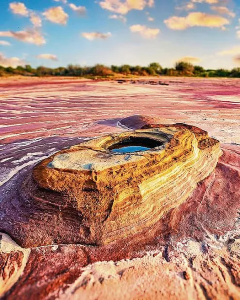
Jatavira is a rust-coloured, eroded landscape that visitors compare to the surface of Mars, one of the most photographed natural sites near Nakhatrana. Early morning and late afternoon light bring out the colours best. Carry water and wear sturdy shoes on the uneven ground.
- What it is
- Natural escape
- Where
- Kutch district, Gujarat
- Distance from Nakhatrana
- Open the directions link for the route.
- By road
- By car or taxi from Nakhatrana. Open the directions link for the current route and road distance.
- Best season
- November to February for the Rann and winter birds; after the monsoon for grasslands.
- Timings and entry
- Outdoor site; visit in daylight.
- Directions
- Google Maps directions from Nakhatrana
Kadiya Dhro
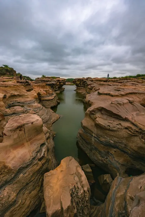
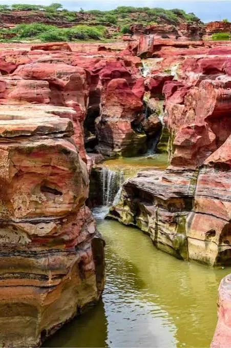
Kadiya Dhro is a canyon of layered rock carved by water and wind, often called the Grand Canyon of Kutch. Its ridges and pools change with the seasons, and after good rain small waterfalls run through the gorge. The rock is slippery when wet, so go with someone who knows the route.
- What it is
- Natural escape
- Where
- Kutch district, Gujarat
- Distance from Nakhatrana
- Open the directions link for the route.
- By road
- By car or taxi from Nakhatrana. Open the directions link for the current route and road distance.
- Best season
- November to February for the Rann and winter birds; after the monsoon for grasslands.
- Timings and entry
- Outdoor site; visit in daylight.
- Directions
- Google Maps directions from Nakhatrana
Banni Grassland Reserve
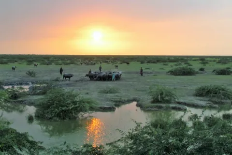
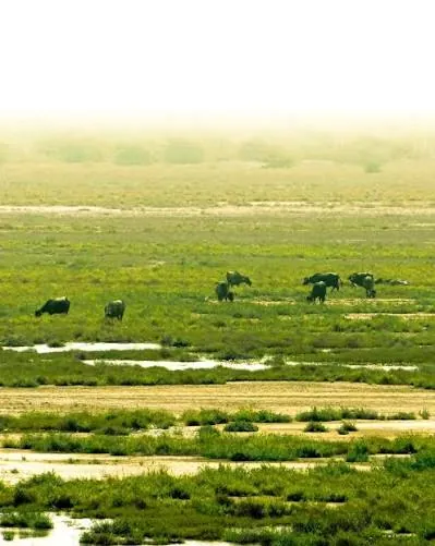
Banni Grassland Reserve covers about 3,847 square kilometres of grassland and seasonal marsh on the southern edge of the Rann of Kutch, often called Asia’s finest natural grassland (Wikipedia). Protected forest since 1955, it has over 150 recorded bird species and about forty hamlets of Maldhari herders, known for their ghee, milk, wool and crafts.
- What it is
- Natural escape
- Where
- Kutch district, Gujarat
- Distance from Nakhatrana
- Open the directions link for the route.
- By road
- By car or taxi from Nakhatrana. Open the directions link for the current route and road distance.
- Best season
- November to February for the Rann and winter birds; after the monsoon for grasslands.
- Timings and entry
- Outdoor site; visit in daylight.
- Nearby
- Chhari Dhand
- Directions
- Google Maps directions from Nakhatrana
Chir batti, the ghost lights of Banni
On dark nights, people in Banni and on the edge of the Rann tell of chir batti, which in Kutchi-Sindhi means ghost light (Wikipedia). It is described as a glowing ball, bright as a street lamp, shifting from blue to red to yellow and floating a few feet above the ground, sometimes darting away and sometimes stopping still. Local lore says it seems to play hide-and-seek with travellers, and anyone who follows it can stray off the road into thorn scrub or the salt flats. The usual explanation offered for lights like these is marsh gas igniting as plant matter decays, though nobody has confirmed what causes chir batti.
Chhari Dhand
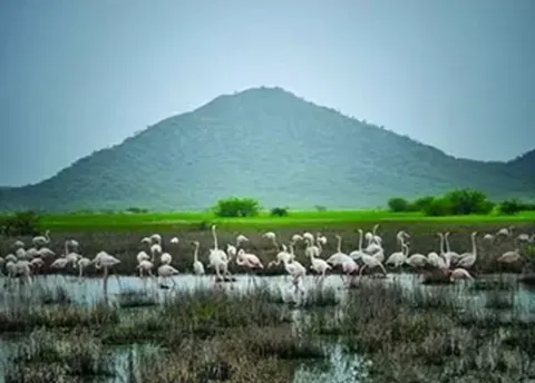
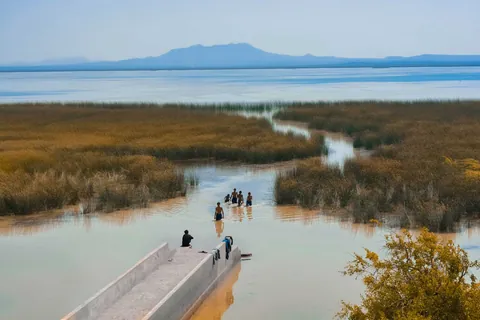
Chhari Dhand is the Banni’s largest seasonal wetland, about 80 square kilometres, protected as a conservation reserve since 2008 (Wikipedia). After a good monsoon it draws up to two lakh birds, including flamingos and common cranes, and Wikipedia lists it as a Ramsar wetland from 2026. It is 29 km north-north-east of Nakhatrana in a straight line.
- What it is
- Natural escape
- Where
- Nakhatrana taluka, Kutch district, Gujarat
- Distance from Nakhatrana
- 29 km north-north-east in a straight line
- By road
- By car or taxi from Nakhatrana. Open the directions link for the current route and road distance.
- Best season
- November to February for the Rann and winter birds; after the monsoon for grasslands.
- Timings and entry
- Outdoor site; visit in daylight.
- Directions
- Google Maps directions from Nakhatrana
Dhordo
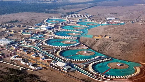
Dhordo is the village at the edge of the Great Rann of Kutch where the white salt desert is most visited and where the Rann Utsav tent city is set up each winter. Full-moon nights on the white Rann are the most sought-after. It is 55 km north-north-east of Nakhatrana in a straight line.
- What it is
- Natural escape
- Where
- Kutch district, Gujarat
- Distance from Nakhatrana
- 55 km north-north-east in a straight line
- By road
- By car or taxi from Nakhatrana. Open the directions link for the current route and road distance.
- Best season
- November to February for the Rann and winter birds; after the monsoon for grasslands.
- Timings and entry
- Outdoor site; visit in daylight.
- Directions
- Google Maps directions from Nakhatrana
Guneri Mangroves
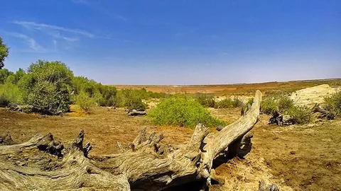
Guneri Mangroves is an inland mangrove forest at Guneri village, unusual because it grows far from the sea, on a patch of land fed by groundwater. It is one of the rarest natural sites in Kutch. Stay on the paths and leave the trees undisturbed.
- What it is
- Natural escape
- Where
- Guneri, Lakhpat taluka, Kutch district, Gujarat
- Distance from Nakhatrana
- Open the directions link for the route.
- By road
- By car or taxi from Nakhatrana. Open the directions link for the current route and road distance.
- Best season
- November to February for the Rann and winter birds; after the monsoon for grasslands.
- Timings and entry
- Outdoor site; visit in daylight.
- Directions
- Google Maps directions from Nakhatrana
Chadva Rakhal
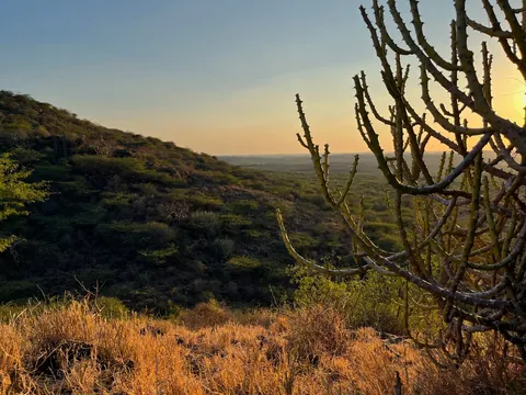
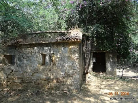
Chadva Rakhal is a protected grassland and scrub reserve; a rakhal was land once set aside as reserved grazing. Today it is a quiet place to see the native thorn scrub and grassland of central Kutch. Carry water and visit in the cooler hours of the day.
- What it is
- Natural escape
- Where
- Kutch district, Gujarat
- Distance from Nakhatrana
- Open the directions link for the route.
- By road
- By car or taxi from Nakhatrana. Open the directions link for the current route and road distance.
- Best season
- November to February for the Rann and winter birds; after the monsoon for grasslands.
- Timings and entry
- Outdoor site; visit in daylight.
- Directions
- Google Maps directions from Nakhatrana
Frequently asked questions
How far is the White Rann from Nakhatrana?
Dhordo, the village on the edge of the white Rann where Rann Utsav is held, is 55 km north-north-east of Nakhatrana in a straight line. The road route is longer. Open the directions link before you leave, and plan to stay until sunset, when the salt flats are at their best.
When is Rann Utsav held?
Rann Utsav is held every winter at Dhordo on the edge of the white Rann, with a tent city, cultural programmes and full-moon nights on the salt flats. It usually runs through the cooler months, but dates change each year, so check them before planning. Book well ahead for full-moon dates, which are the busiest.
What makes the Guneri mangroves unusual?
Mangroves usually grow along sea coasts and tidal creeks, but the mangrove patch at Guneri village grows inland, well away from the sea, on land fed by groundwater. That makes it one of the rarest natural sites in Kutch and a curiosity for anyone interested in plants and ecology. Stay on paths and do not disturb the trees.
Where can you see birds near Nakhatrana?
Chhari Dhand, a seasonal wetland on the edge of the Banni grasslands, is the best-known birding spot, with large winter flocks from November to February after the monsoon fills it. The wider Banni Grassland Reserve is also rich in birds. Carry binoculars, go early in the morning and keep a respectful distance from flocks.
What is Kadiya Dhro?
Kadiya Dhro is a canyon of layered rock carved by water and wind, often called the Grand Canyon of Kutch for its ridges, pools and colours. The walk in is uneven and can be slippery after rain, so wear good shoes and avoid it during heavy monsoon showers. After good rain, small waterfalls run over the red rock.