નખત્રાણા
Nakhatrana
Kutch was first ruled from here. Today it is the base for western Kutch.
Nakhatrana is a town of 17,478 people (Census 2011) and the headquarters of Nakhatrana taluka in Kutch, Gujarat, 42 km west-north-west of Bhuj. From here the white Rann, Paddhar Gadh, the Harappan town of Khirasara, Narayan Sarovar, Lakhpat and Mandvi’s beach are all within a day’s drive.
White Rann 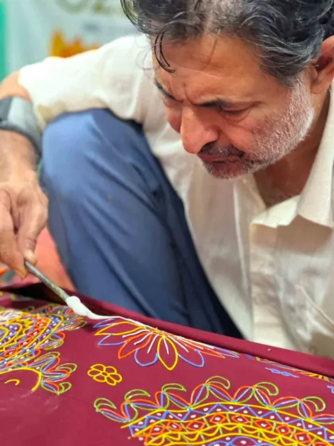
Rogan, Nirona 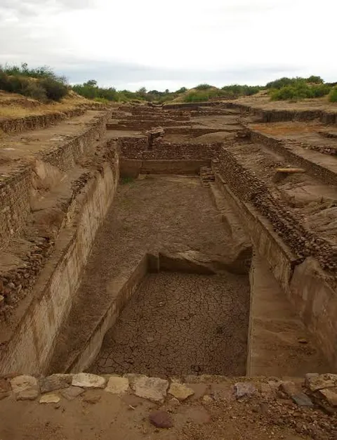
Dholavira 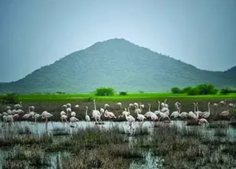
Chhari Dhand 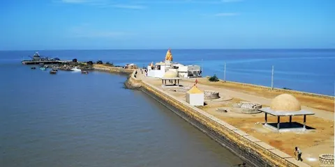
Koteshwar 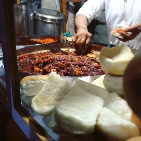
Dabeli
60 places, sights and tastes of Kutch, in eight chapters. How many have you really seen?
શું તમે ખરેખર કચ્છ જોયું છે?
Have you really seen Kutch?
Many visitors see the white Rann and Bhuj, and leave thinking they have seen Kutch. This checklist holds 60 places, sights and tastes in eight chapters, from salt flats and Harappan towns to craft villages and the coast. Tick the ones you have seen, and the rest become a three-day plan from Nakhatrana.
Tap a card if you have been there. Your score and your plan build up at the end of the list.
રણ અને આકાશ
Salt and sky
The white desert, the highest hill in Kutch and the lights nobody has explained.
0 of 7 seen
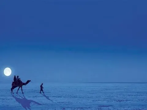
The white Rann under a full moon
On full-moon nights the salt crust of the Great Rann turns silver-white to the horizon. Dhordo is where most people walk out onto it.
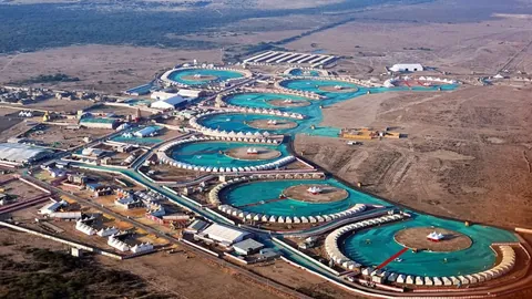
A night in the Rann Utsav tent city
Every winter Gujarat Tourism pitches a tent city at Dhordo, with folk music, craft stalls and camel carts on the salt.
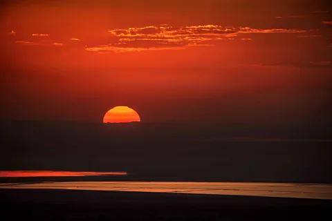
Sunset from Kalo Dungar
At about 462 metres, the Black Hill is the highest point in Kutch. From the top, the Great Rann runs flat and white to the horizon.
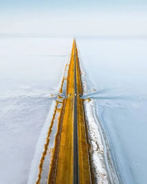
The Road to Heaven
A long, straight road across the Rann towards Dholavira, with salt flats on both sides and almost nothing else in sight.
Chir batti, the ghost lights of Banni
Herders tell of lights that dance above the Banni and the Rann on dark nights. Nobody has fully explained them.
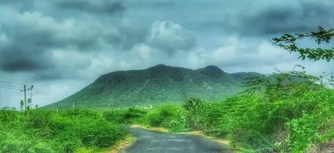
Dhinodhar in the monsoon
A 361-metre hill with a shrine to Guru Dharamnath at the top. The Tropic of Cancer passes its southern tip.
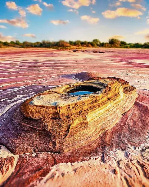
The Mars-red ground of Jatavira
A rust-coloured, eroded landscape that visitors compare to the surface of Mars. Go early or late, when the colours glow.
૪,૫૦૦ વર્ષ
4,500 years
Harappan towns, a Buddhist cave, a battlefield, a port town emptied by one earthquake and the memorial to another.
0 of 9 seen
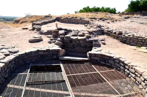
Khirasara, a Harappan town
People lived here from about 2600 to 2200 BCE. Digs from 2009 found a fort wall, a warehouse and houses.
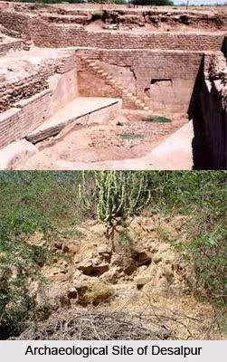
Desalpar Gunthli
A Harappan site of the 3rd millennium BCE, excavated in 1963 and one of the closest to Nakhatrana.
Dholavira, the UNESCO Harappan city
One of the great cities of the Indus civilisation, listed as a World Heritage Site in 2021. Its stone reservoirs stored every drop of rain.
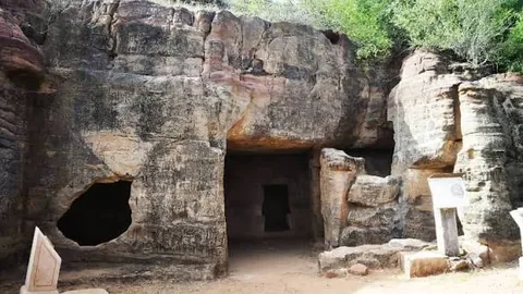
The Siyot rock-cut caves
A Buddhist cave shrine of the 2nd or 3rd century CE, used by Buddhists for centuries and later by Shaivas.
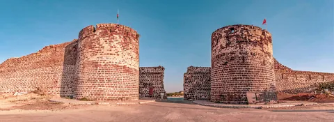
The 7 km walls of Lakhpat
A port town on Kori Creek inside a fort wall about 7 km long. It declined after the 1819 earthquake.
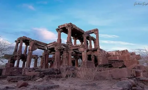
The ruins of Paddhar Gadh
Carved stone pillars and beams of an old fort town still stand, beside a small stone shrine.
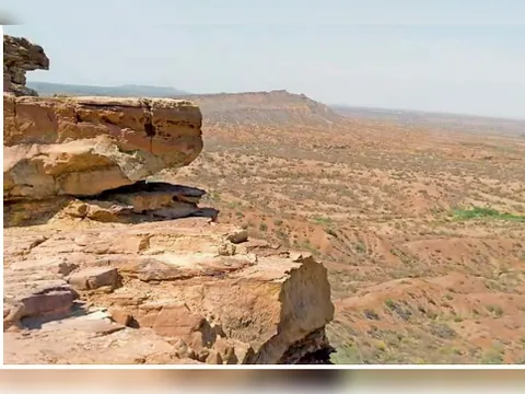
Zara, the battlefield of 1762
An invading army from Sindh defeated the forces of Kutch here in 1762, a turning point for the old Cutch State.
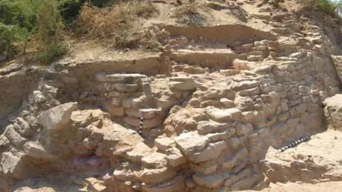
The Kanmer excavation
A small fortified Harappan settlement in Rapar taluka, in the far east of Kutch, excavated in the 2000s.
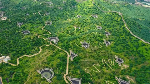
Smritivan, the earthquake memorial
A memorial on Bhujiyo Hill in Bhuj to the people who died in the 2001 earthquake, with a museum on the quake and how Kutch rebuilt.
આસ્થા
Faith
Temples, a dargah, a gurdwara and Jain tirths on the pilgrim roads of the west.
0 of 8 seen
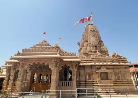
Mata no Madh
Temple of Ashapura Mata, family deity of the Jadeja rulers. In Navratri thousands walk here on foot, many through Nakhatrana.
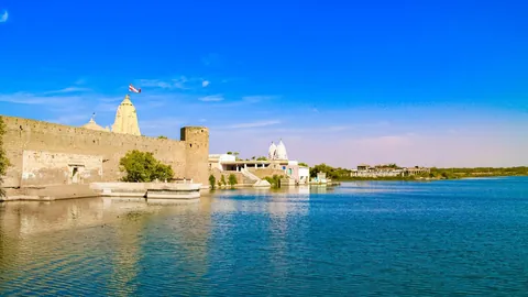
Narayan Sarovar
One of the five sacred lakes of Hindu tradition, at the far western edge of Kutch.
Koteshwar, the last temple west
A Shiva temple at the westernmost tip of Kutch, looking over the creek to the open sea. Its legend ties the linga to Ravana.
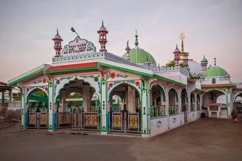
The Hajipir dargah
A saint’s dargah on the edge of the Banni, visited by Muslims and Hindus alike. Its fair falls in April.
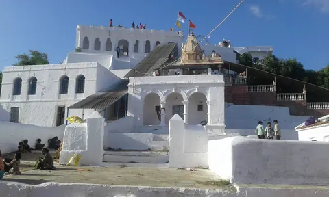
Yaksh 72 at fair time
A temple to 72 Jakhs, the semi-legendary heroes of western Kutch. Its September fair draws huge crowds.
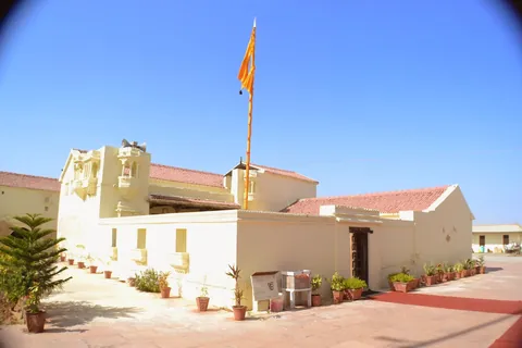
The gurdwara at Lakhpat
A gurdwara associated with Guru Nanak, inside the walls of a former port town.
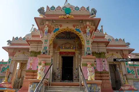
Tera Jain Tirth
The Shri Tera Jirawalla Parshvanath tirth, in a village that is also the seat of a Jadeja estate.
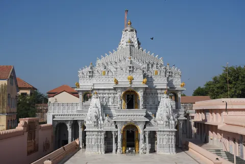
Suthari Jain Tirth
A Jain pilgrimage centre whose derasar dates from about 1838, in a village with its own beach.
હસ્તકલા
Craft
Villages where a craft passes down inside one family, sometimes for eight generations.
0 of 8 seen
Rogan painting in Nirona
Castor oil is boiled into a paste and drawn freehand onto cloth. One family has kept the art alive for eight generations.
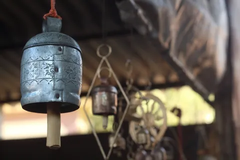
Copper bells hammered by hand
In Nirona, bells are beaten by hand from scrap iron and coated in copper.
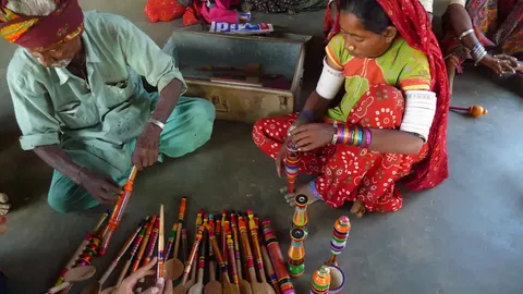
Lacquerwork on a hand lathe
The Vadha community turns wood on hand lathes and colours it with lacquer as it spins.
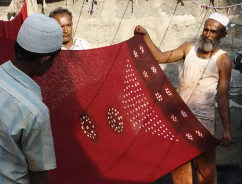
Bandhani in Bhadli
Khatri families tie and dye cloth here; one workshop’s family business goes back more than seven generations.
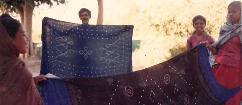
Wool bandhani of Moti Virani
Red and black woollen shawls tie-dyed for Rabari and Bharwad families. Only three or four families still make them.
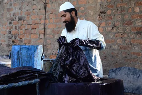
Ajrakh at Ajrakhpur
Block printers moved here from Dhamadka after the 2001 earthquake. Each ajrakh cloth goes through many rounds of printing, dyeing and washing.
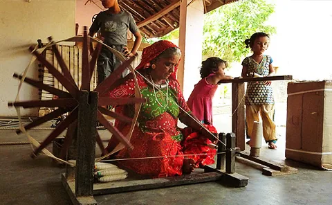
The weavers of Bhujodi
A weaving village outside Bhuj, where Vankar families weave shawls and blankets on handlooms.
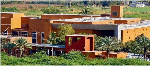
Living and Learning Design Centre
A crafts museum near Bhuj, set up by Shrujan, showing the embroidery of the many communities of Kutch side by side.
સ્વાદ
Taste
Kutch is far more than dabeli, though Nakhatrana’s dabeli is the right place to start.
0 of 7 seen
Nakhatrana’s spicy dabeli
The Kutchi spiced-potato bun, and Nakhatrana’s version is known for its heat. Try it fresh in the evening.
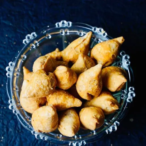
Dungri samosa
An onion-heavy samosa that people across Kutch link with Nakhatrana.
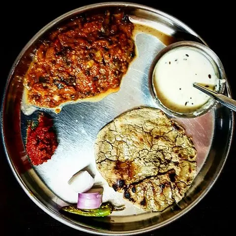
Bajra rotlo with odho
Thick millet flatbread with ghee and fire-roasted brinjal mash: the classic Kutchi village meal.

Double-colour gulab pak
A rose-petal milk sweet. M H Sweets in Nakhatrana makes a two-colour version.
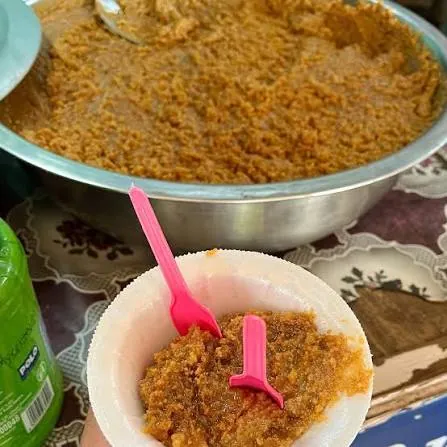
Meetha mava from Bhirandiyara
A sweet of slowly reduced milk, best known from Bhirandiyara on the road to the white Rann.
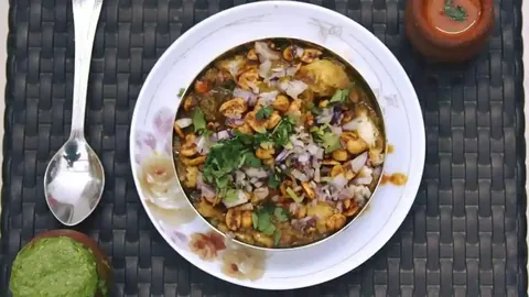
Kadak in Bhuj
Crisp toasted pav tossed with masala, one of the street snacks of Bhuj.
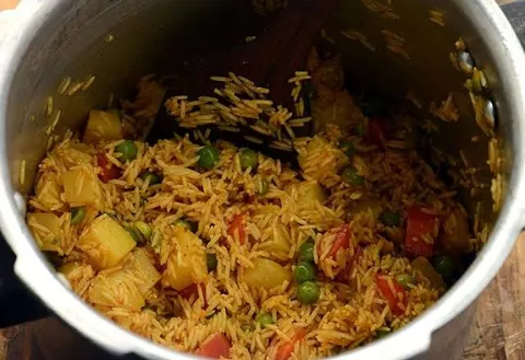
Khari bhaat
Spicy rice cooked with potato and whole spices, a Kutchi one-pot meal.
કુદરત
Wild
Flamingos, Asia’s finest grassland, mangroves far from the sea and 150-million-year-old fossils.
0 of 8 seen
Flamingos at Chhari Dhand
After a good monsoon this wetland draws up to two lakh birds, flamingos and common cranes among them.
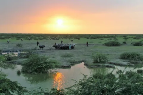
Sunset over the Banni
About 3,847 square kilometres of grassland, often called Asia’s finest, grazed by Maldhari herders and their buffaloes.
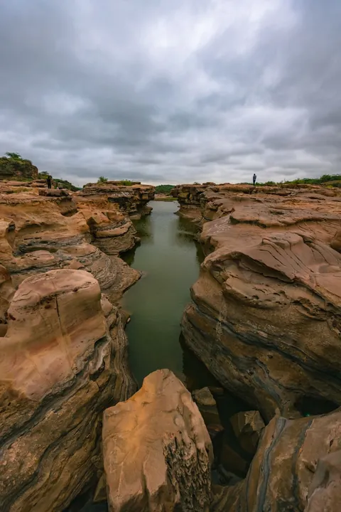
The canyon of Kadiya Dhro
Layered rock carved by water and wind, often called the Grand Canyon of Kutch. After rain, small waterfalls run through it.
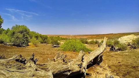
Mangroves far from the sea
At Guneri a mangrove forest grows inland, fed by groundwater: one of the rarest natural sites in Kutch.
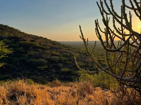
Chadva Rakhal
Old reserved grazing land, now a quiet reserve of the native thorn scrub and grassland of central Kutch.
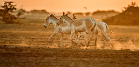
Wild ass in the Little Rann
The Little Rann of Kutch is the last home of the Indian wild ass, a fast, pale relative of the horse.
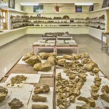
Kutch Fossil Park
One man’s 45-year collection: ammonites, dinosaur teeth and a sea cow, some finds up to 150 million years old.
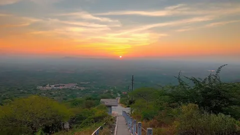
Climb Nanamo, Varar or Bhikhurushi
Three short climbs within 30 km of town, with wide views over the farmland of central Kutch.
રાજવી
Royal
Kutch was first ruled from near Nakhatrana. The palaces and darbargadhs tell the rest.
0 of 7 seen
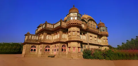
Vijay Vilas Palace
A 1920s summer palace with its own beach at Mandvi, seen in Lagaan and Hum Dil De Chuke Sanam.
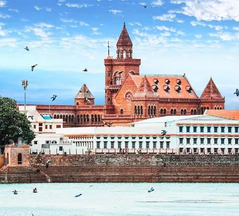
Aina Mahal, Bhuj
The Hall of Mirrors, an 18th-century palace in Bhuj lined with glass and mirror work.
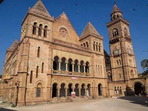
Prag Mahal, Bhuj
A 19th-century palace in the Italian Gothic style, with a clock tower over the old capital.
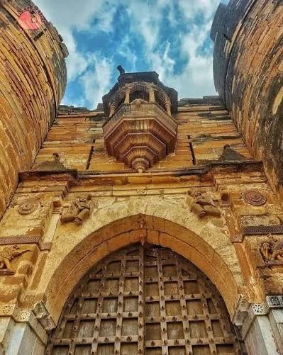
Tera Darbargadh
Fort-palace of the Jadeja jagirdars of Tera, scarred by war and earthquake and partly repaired.
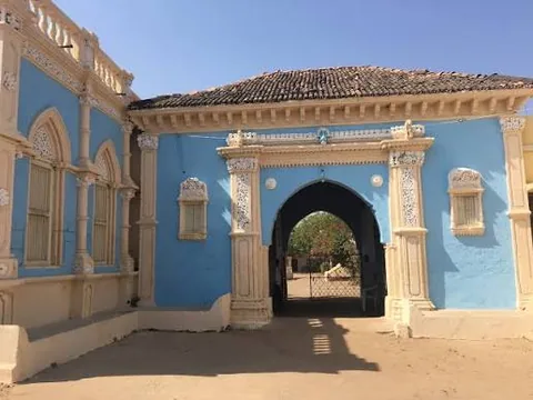
The darbargadh at Devpar
The seat of a Jadeja jagir, one of many estates held by relatives of the Kutch rulers across the west.
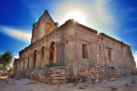
Roha Fort and the poet Kalapi
A hill fort on an estate once of 52 villages. Kalapi, the great Gujarati poet, married a princess of Roha.
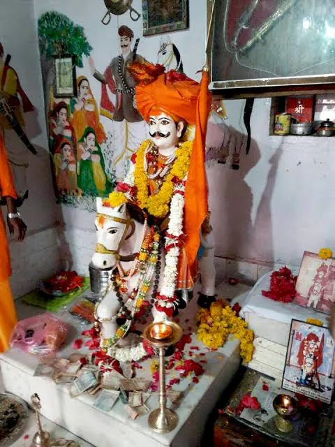
The shrine of Jam Abda
A 14th-century ruler who died defending refugees. Abdasa taluka is named after him.
દરિયાકાંઠો
Coast
Dhow yards, a palace on the beach and shorelines with nobody on them.
0 of 6 seen
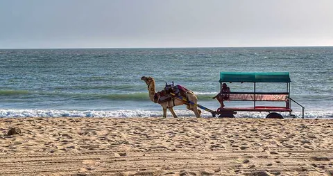
Mandvi Beach
The best-known beach in Kutch, at an old port town on the Gulf of Kutch.
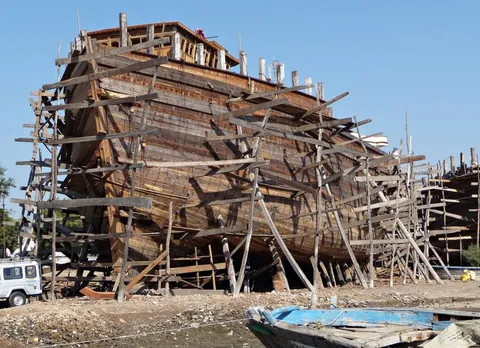
Dhows built by hand in Mandvi
Mandvi’s yards still build large wooden ships by hand on the riverbank.
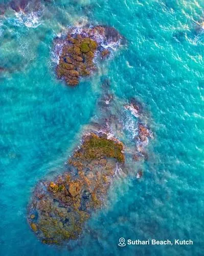
Suthari Beach
Rocks and clear water on the Abdasa coast, in the same village as a Jain tirth.
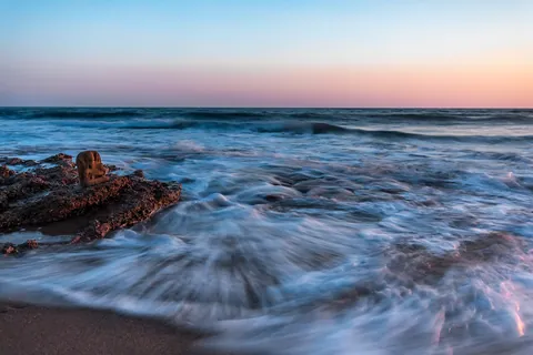
Pingleshwar Beach
Golden sand near Naliya, a Mahadev temple beside the sea and wind farms along the coast.
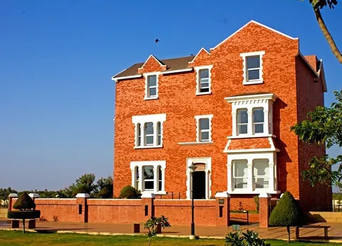
Kranti Teerth
A replica of India House, London, near Mandvi, honouring the freedom fighter Shyamji Krishna Varma.
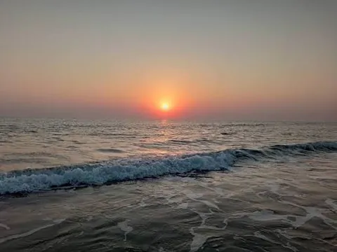
Chhachhi Beach
An empty shoreline in Mandvi taluka that few visitors ever find.
તમારું પરિણામ
You’ve seen 0 of 60.
100% of Kutch is still waiting.
Tick the places you have been to, and your score appears here.
- Salt and sky0/7
- 4,500 years0/9
- Faith0/8
- Craft0/8
- Taste0/7
- Wild0/8
- Royal0/7
- Coast0/6
What you’ve missed, as three days from Nakhatrana
What is Nakhatrana?
Nakhatrana is a town and taluka headquarters in Kutch district, Gujarat, at about 23.35° N, 69.26° E and 42 km west-north-west of Bhuj. The 2011 Census counted 17,478 people in 3,503 households. The town is known across Kutch for spicy dabeli, onion samosas and bangles, and it sits on the main road from Bhuj to the far west.
See the full Nakhatrana fact sheet, with census figures, codes, administration and climate.
How did Nakhatrana get its name?
Wikipedia records a local tale: Paliwal Brahmins who migrated from Pali to Kutch were granted “the greenest part of Kutch without any document”, and khat is the Gujarati word for such a deed. The name is linked to that grant made without a written khat. Like many place-name stories, it is told in more than one version.
Joshi is a common surname among the town’s Brahmin families, according to the same article (Wikipedia).
Was Kutch once ruled from Nakhatrana?
Yes, from close by. According to Wikipedia, the rulers of Kutch governed from Lakhiarviro, near present-day Nakhatrana, from 1147 to 1548, and moved the capital to Bhuj in 1549. So for four centuries the seat of Kutch stood in this part of the region, before Bhuj began its long run as capital.
Lakhiarviro, known locally as Lakhiyaviro or Lakhiyavira, was named after Lakhiar, twin brother of its founder (Wikipedia: Cutch State). See Lakhiyaviro on Google Maps. Today Bhuj is the district headquarters and the gateway to Kutch, with its airport and railway station; Nakhatrana is where western Kutch begins.
Why Nakhatrana is the tourism capital of Kutch?
Nakhatrana is the tourism capital of Kutch for anyone heading west, because it sits at the centre of the region: 12 of the 19 places measured in this guide are within 40 km, and the white Rann, Narayan Sarovar, Lakhpat and Mandvi are within about 85 km. Bhuj stays the capital and gateway; Nakhatrana is the base beyond it.
- Kutch was first ruled from here. The rulers of Kutch governed from Lakhiarviro, near present-day Nakhatrana, from 1147 to 1548, before moving the capital to Bhuj in 1549.
- It is the centre of western Kutch. The white Rann lies north at Dhordo (55 km), the far-western shrines north-west at Lakhpat (73 km) and Narayan Sarovar (83 km), the Abdasa coast south-west and Mandvi due south (58 km).
- Ancient sites are close by. The ruins of Paddhar Gadh, with their carved stone pillars, and the Harappan town of Khirasara, 36 km away and about 4,500 years old, are within easy reach of Nakhatrana.
- It stands on the pilgrim road. Thousands walk to Mata no Madh during Navratri, and many pass through Nakhatrana. Dhinodhar, Yaksh 72 and Hajipir are all close.
- Crafts and food are on the doorstep. Nirona’s Rogan artists are 29 km away, and Nakhatrana’s own spicy dabeli is famous across Kutch.
- Bhuj is next door. Bhuj, 42 km away, is the capital and gateway, with the airport and railhead. Arrive through Bhuj, then base yourself in Nakhatrana for the west.
See all 43 places on the Nakhatrana Wheel, plotted by real direction and distance.
- Beaches
- Hills
- Religious Places
- Archaeological Sites
- Natural Escapes
- Handicraft Hubs
- Bhuj
Directions and straight-line distances from the centre of Nakhatrana, read from Google Maps. Rings are 20 km apart on a square-root scale. Road distances are longer.
What can you see near Nakhatrana?
This guide lists 43 places within a day trip of Nakhatrana, in 10 categories: beaches, hills, historical places, religious places, archaeological sites, royal estates, natural escapes, handicraft villages, museums and food trails. Each place has a straight-line distance where measured, the best season and a Google Maps directions link from town.
- Beaches4 placesSuthari Beach, Mandvi Beach, Chhachhi Beach, Pingleshwar Beach
- Hills4 placesBhikhurushi, Dhinodhar Hill, Nanamo Hill, Varar Hill
- Historical Places4 placesThan Jagir, Roha Fort, Veer Jam Abda Adbhang Dada, Zara (Jara)
- Religious Places9 placesYaksh 72 (Jakh Botera), Tera Jain Tirth, Hajipir, Suthari Jain Tirth, Lakhpat, Narayan Sarovar, Mata no Madh, Koteshwar Mahadev, Vandhay
- Archaeological Sites4 placesPaddhar Gadh, Desalpar Gunthli, Khirasara, Siyot Caves
- Royal Families2 placesTera Darbargadh, Devpar
- Natural Escapes7 placesChhari Dhand, Dhordo, Jatavira, Kadiya Dhro, Banni Grassland Reserve, Guneri Mangroves, Chadva Rakhal
- Handicraft Hubs3 placesNirona, Virani, Bhadli
- Museums & Collections3 placesVijay Vilas Palace, Kutch Fossil Park, Shyamji Krishna Varma Memorial
- Food Trails3 placesNakhatrana Dabeli & Chaats, Bhajiyas & Vadas, Sweet Mava
How do you reach Nakhatrana?
Fly or take the train to Bhuj, the nearest airport and railway station, 42 km east, then continue by road. Private buses run by operators including HK, Patel and Ramani, and GSRTC state buses, reach Nakhatrana directly. Drivers from Ahmedabad come via Surajbari, Bhachau and Bhuj.
Read the full guide to reaching Nakhatrana: air, rail, bus and the self-drive route.
When should you visit Nakhatrana?
Visit between October and February for cool days and the winter Rann Utsav at the white Rann. Come during Navratri to see the foot pilgrimage to Mata no Madh, in September for the Yaksh and Ramdevji fairs, or in the monsoon for seasonal waterfalls and green hills. March to June is hot, often above 40°C.
Gallery
A look at Nakhatrana and the places around it: the white Rann at Dhordo under a full moon, Dhinodhar Hill in the monsoon, a Rogan artist at work in Nirona, the walls of Lakhpat, Narayan Sarovar, the Harappan reservoir at Dholavira, the dhow yards of Mandvi and a pan of Kutchi dabeli.
White Rann, Dhordo Lakhpat fort walls 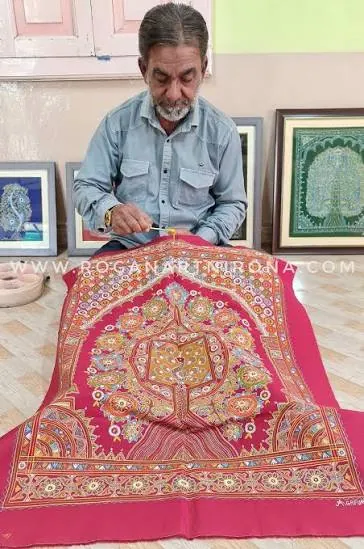
Rogan art, Nirona Harappan reservoir, Dholavira Narayan Sarovar Mandvi dhow yard Dhinodhar Hill Kutchi dabeli
Frequently asked questions
Where is Nakhatrana?
Nakhatrana is a town in Kutch district, Gujarat, in western India, at about 23.35° N, 69.26° E. It lies 42 km west-north-west of Bhuj in a straight line, on the main road from Bhuj towards Lakhpat and Narayan Sarovar. It is the headquarters of Nakhatrana taluka, one of the ten talukas of Kutch, and its PIN code is 370615.
Why is Nakhatrana called the tourism capital of Kutch?
Because it is the most central base for western Kutch. 12 of the places measured in this guide are within 40 km of the town, and the white Rann, Narayan Sarovar, Lakhpat and Mandvi are within about 85 km. Kutch was also first ruled from Lakhiarviro, near Nakhatrana. Bhuj remains the district capital and the gateway for arrivals.
How far is Nakhatrana from Bhuj?
Nakhatrana is 42 km from Bhuj in a straight line, to the west-north-west. The road distance is longer. [VERIFY: road distance and usual driving time from Bhuj to Nakhatrana] Bhuj has the nearest airport and railway station, and GSRTC buses, private buses and taxis connect the two towns. Drivers simply take the main road west out of Bhuj, towards Lakhpat and Narayan Sarovar.
What is Nakhatrana famous for?
Nakhatrana is famous for its spicy dabeli, the Kutchi spiced-potato bun, for spicy onion samosas and for its bangles, according to Wikipedia. For travellers it is best known as the base for western Kutch: Dhinodhar Hill, the ruins of Paddhar Gadh, the Harappan town of Khirasara, the Rogan village of Nirona and the Navratri pilgrim road to Mata no Madh.
What is the population of Nakhatrana?
The 2011 Census of India recorded a population of 17,478 for Nakhatrana, living in 3,503 households, with a literacy rate of 82.59% and a sex ratio of 983 females per 1,000 males. The 2001 Census had counted 12,534 people. Figures from the next census were not available when this guide was published.
What language is spoken in Nakhatrana?
Kutchi, Gujarati and Hindi are spoken in Nakhatrana. Kutchi is the everyday language of the region, Gujarati is the state language used on signs, in schools and in offices, and Hindi is widely understood. Visitors who speak only English will find it understood in hotels and by younger people, but a few Gujarati or Hindi words help.
Is Nakhatrana worth visiting?
Yes, for anyone exploring western Kutch. Nakhatrana puts the white Rann, Harappan sites, Jain tirths, the far-western shrines and the Mandvi coast within a day’s drive, and it is less crowded than the district capital. It also has its own reasons to stop: Dhinodhar Hill on the Tropic of Cancer is 15 km away, and the dabeli is famous.
When is the best time to visit Nakhatrana?
October to February is the best time for most visitors, with cool, dry days and the white Rann at its best during the winter Rann Utsav. Navratri brings the foot pilgrimage to Mata no Madh, and the July to September monsoon turns the hills green and fills seasonal streams. March to June is hot, with temperatures that can exceed 40°C.